


Clackamas County (South & East)--Damascus City PUMA, Oregon
About
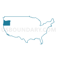
Outline
--Damascus+City+PUMA%2c+Oregon_A280.png)
Summary
| Unique Area Identifier | 193834 |
| Name | Clackamas County (South & East)--Damascus City PUMA |
| State | Oregon |
| Area (square miles) | 1,726.31 |
| Land Area (square miles) | 1,718.94 |
| Water Area (square miles) | 7.37 |
| % of Land Area | 99.57 |
| % of Water Area | 0.43 |
| Latitude of the Internal Point | 45.12214640 |
| Longtitude of the Internal Point | -122.18682580 |
Maps
--Damascus+City+PUMA in Oregon.png)
Graphs
Select a template below for downloading or customizing gragh for Clackamas County (South & East)--Damascus City PUMA, Oregon
--Damascus+City+PUMA%2c+Oregon_T0.png)
--Damascus+City+PUMA%2c+Oregon_T1.png)
--Damascus+City+PUMA%2c+Oregon_T2.png)
--Damascus+City+PUMA%2c+Oregon_T3.png)
--Damascus+City+PUMA%2c+Oregon_T4.png)
--Damascus+City+PUMA%2c+Oregon_T5.png)
--Damascus+City+PUMA%2c+Oregon_T6.png)
--Damascus+City+PUMA%2c+Oregon_T7.png)
--Damascus+City+PUMA%2c+Oregon.png)
Neighbors
Neighoring Public Use Microdata Area (by Name) Neighboring Public Use Microdata Area on the Map
- Clackamas County (Northwest)--Lake Oswego, West Linn, Wilsonville & Canby Cities PUMA, OR
- Clackamas County (Northwest)--Oregon City, Milwaukie & Happy Valley Cities PUMA, OR
- Marion County (Outside Salem & Keizer Cities)--Woodburn & Silverton Cities PUMA, OR
- Multnomah County (East)--Gresham & Troutdale Cities PUMA, OR
- North Central Oregon--The Dalles City PUMA, OR
Top 10 Neighboring County (by Population) Neighboring County on the Map
- Multnomah County, OR (735,334)
- Clackamas County, OR (375,992)
- Marion County, OR (315,335)
- Wasco County, OR (25,213)
- Hood River County, OR (22,346)
Top 10 Neighboring County Subdivision (by Population) Neighboring County Subdivision on the Map
- Portland East CCD, Multnomah County, OR (462,994)
- Northwest Clackamas CCD, Clackamas County, OR (248,731)
- Gresham CCD, Multnomah County, OR (140,571)
- Woodburn CCD, Marion County, OR (30,562)
- Wilsonville CCD, Clackamas County, OR (20,957)
- Sandy CCD, Clackamas County, OR (19,963)
- Canby CCD, Clackamas County, OR (18,361)
- Estacada CCD, Clackamas County, OR (15,451)
- Silverton CCD, Marion County, OR (15,259)
- Molalla CCD, Clackamas County, OR (12,741)
Top 10 Neighboring Place (by Population) Neighboring Place on the Map
- Gresham city, OR (105,594)
- Oregon City city, OR (31,859)
- Canby city, OR (15,829)
- Happy Valley city, OR (13,903)
- Damascus city, OR (10,539)
- Sandy city, OR (9,570)
- Molalla city, OR (8,108)
- Mount Hood Village CDP, OR (4,864)
- Beavercreek CDP, OR (4,485)
- Estacada city, OR (2,695)
Top 10 Neighboring Unified School District (by Population) Neighboring Unified School District on the Map
- North Clackamas School District 12, OR (113,237)
- Gresham-Barlow School District 1J, OR (76,354)
- Oregon City School District 62, OR (54,748)
- West Linn School District 3J, OR (45,262)
- Centennial School District 28J, OR (41,431)
- Canby School District 86, OR (30,183)
- Oregon Trail School District 46, OR (28,463)
- Woodburn School District 103, OR (27,070)
- Hood River County School District 1, OR (22,346)
- Silver Falls School District 4J, OR (19,162)
Top 10 Neighboring State Legislative District Lower Chamber (by Population) Neighboring State Legislative District Lower Chamber on the Map
- State House District 48, OR (76,579)
- State House District 50, OR (68,207)
- State House District 39, OR (65,719)
- State House District 37, OR (63,742)
- State House District 52, OR (63,241)
- State House District 51, OR (62,900)
- State House District 18, OR (62,291)
- State House District 17, OR (61,383)
- State House District 59, OR (60,455)
Top 10 Neighboring State Legislative District Upper Chamber (by Population) Neighboring State Legislative District Upper Chamber on the Map
- State Senate District 24, OR (141,304)
- State Senate District 25, OR (134,239)
- State Senate District 26, OR (126,141)
- State Senate District 20, OR (125,136)
- State Senate District 9, OR (123,674)
- State Senate District 19, OR (121,745)
- State Senate District 30, OR (115,913)
Top 10 Neighboring 111th Congressional District (by Population) Neighboring 111th Congressional District on the Map
- Congressional District 2, OR (769,987)
- Congressional District 3, OR (762,155)
- Congressional District 5, OR (757,128)
Top 10 Neighboring Census Tract (by Population) Neighboring Census Tract on the Map
- Census Tract 89.01, Multnomah County, OR (9,415)
- Census Tract 104.09, Multnomah County, OR (7,436)
- Census Tract 226.05, Clackamas County, OR (7,363)
- Census Tract 102.02, Marion County, OR (7,205)
- Census Tract 227.02, Clackamas County, OR (6,685)
- Census Tract 232.02, Clackamas County, OR (6,487)
- Census Tract 238, Clackamas County, OR (6,414)
- Census Tract 99.03, Multnomah County, OR (6,219)
- Census Tract 104.02, Multnomah County, OR (6,135)
- Census Tract 231, Clackamas County, OR (6,127)
Top 10 Neighboring 5-Digit ZIP Code Tabulation Area (by Population) Neighboring 5-Digit ZIP Code Tabulation Area on the Map
- 97045, OR (51,359)
- 97080, OR (40,888)
- 97071, OR (28,803)
- 97068, OR (28,305)
- 97086, OR (26,010)
- 97013, OR (22,688)
- 97015, OR (19,521)
- 97055, OR (17,350)
- 97038, OR (15,113)
- 97381, OR (14,711)